Study Area Maps
The study areas addressed by the District Plan are the greater 30th Street Station complex and the adjacent neighborhoods. The Primary Study Area is the boundary for physical interventions contemplated by the Coordinating Committee, primarily focusing on the station and facilities, transportation infrastructure, potential rail yard overbuild, and commercial opportunities. The 30th Street Station District, comprised of the Primary Study Area and surrounding neighborhoods, were studied for its potential to impact and be impacted by the Primary Study Area.
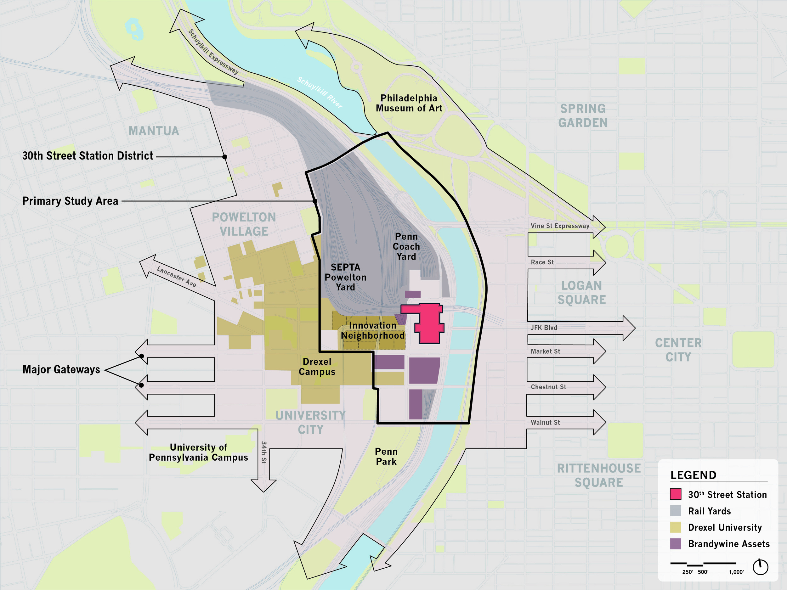
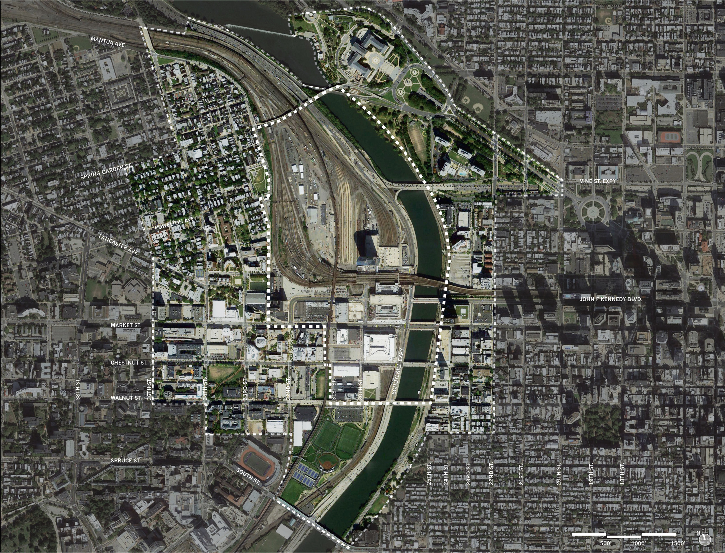
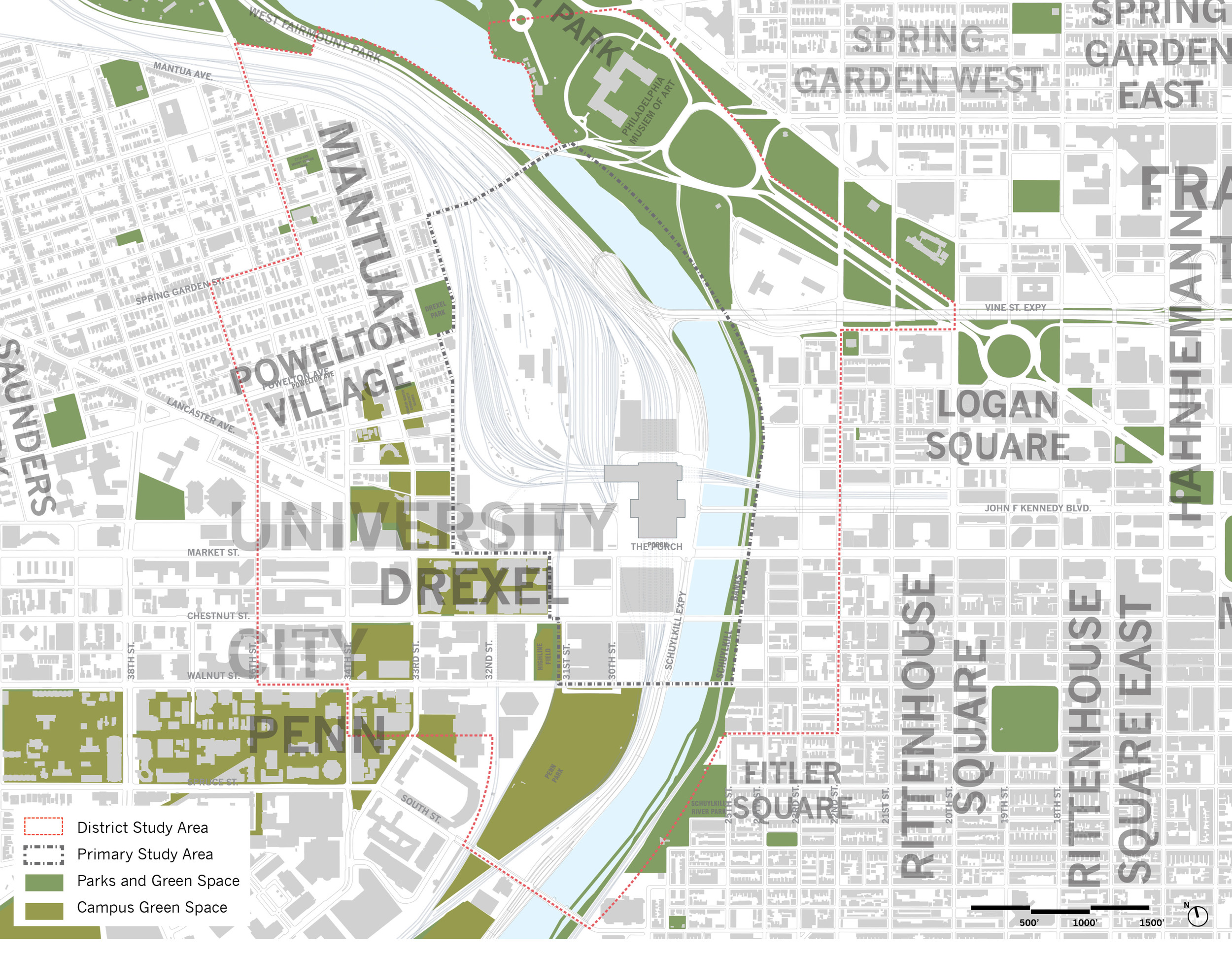
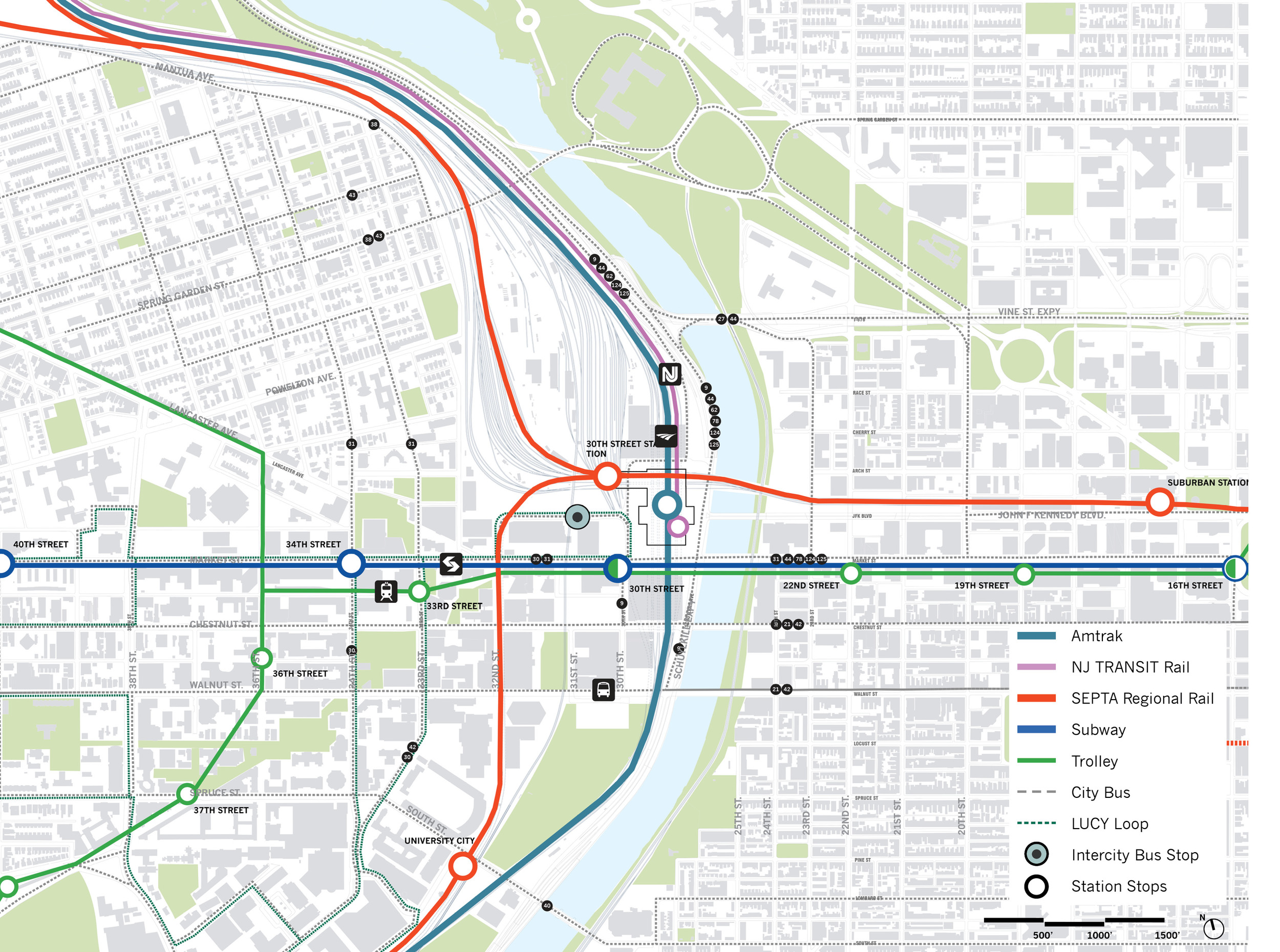
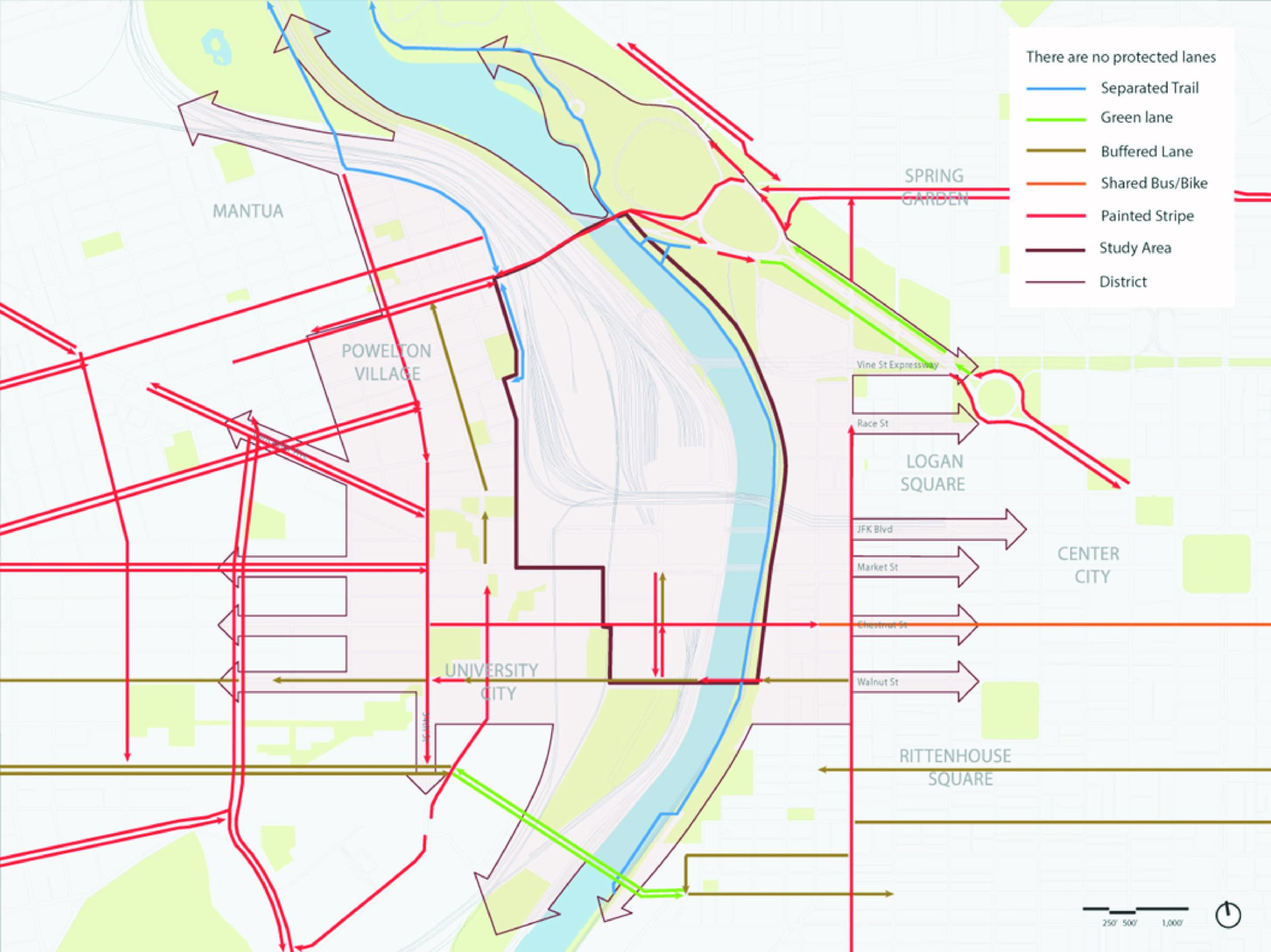
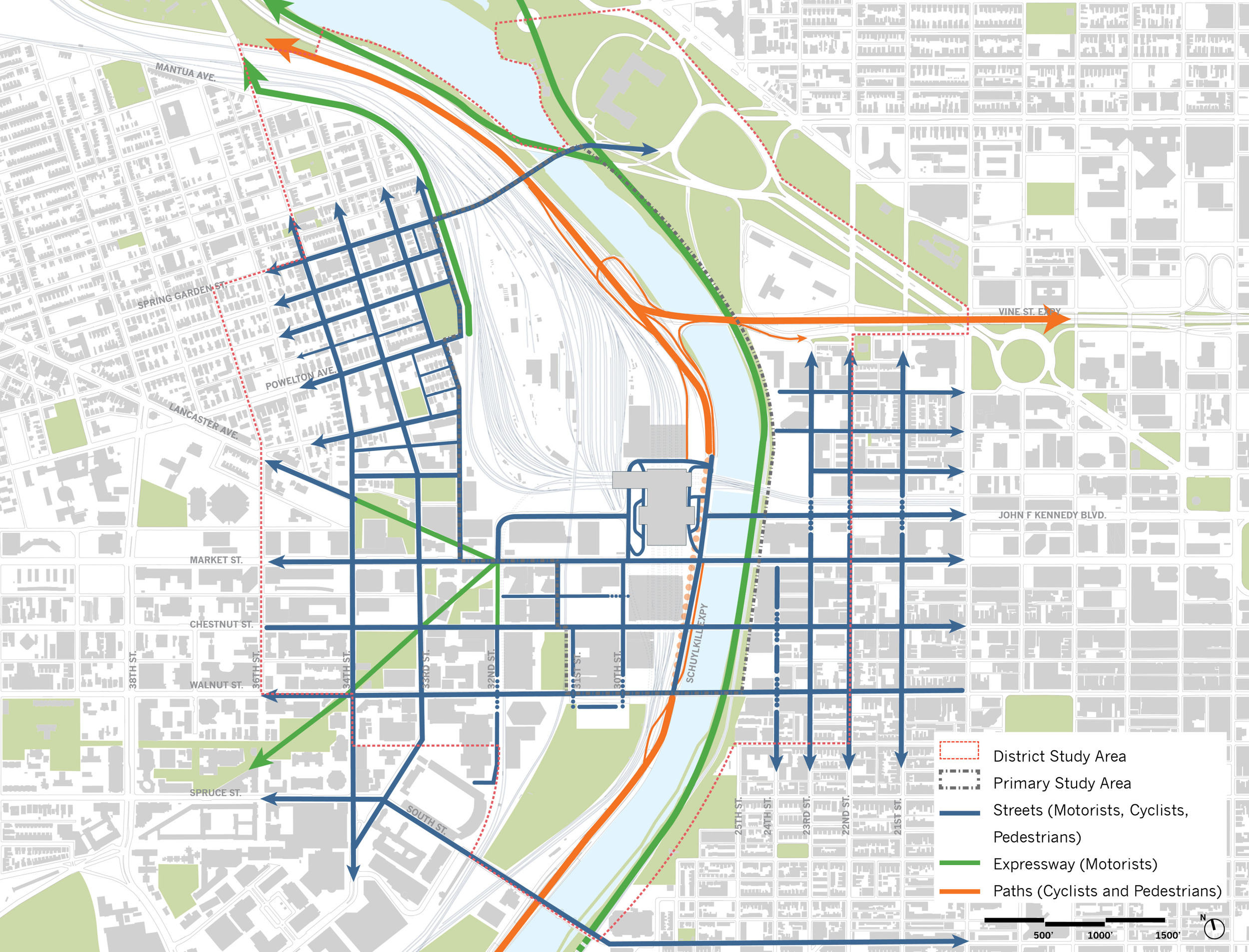
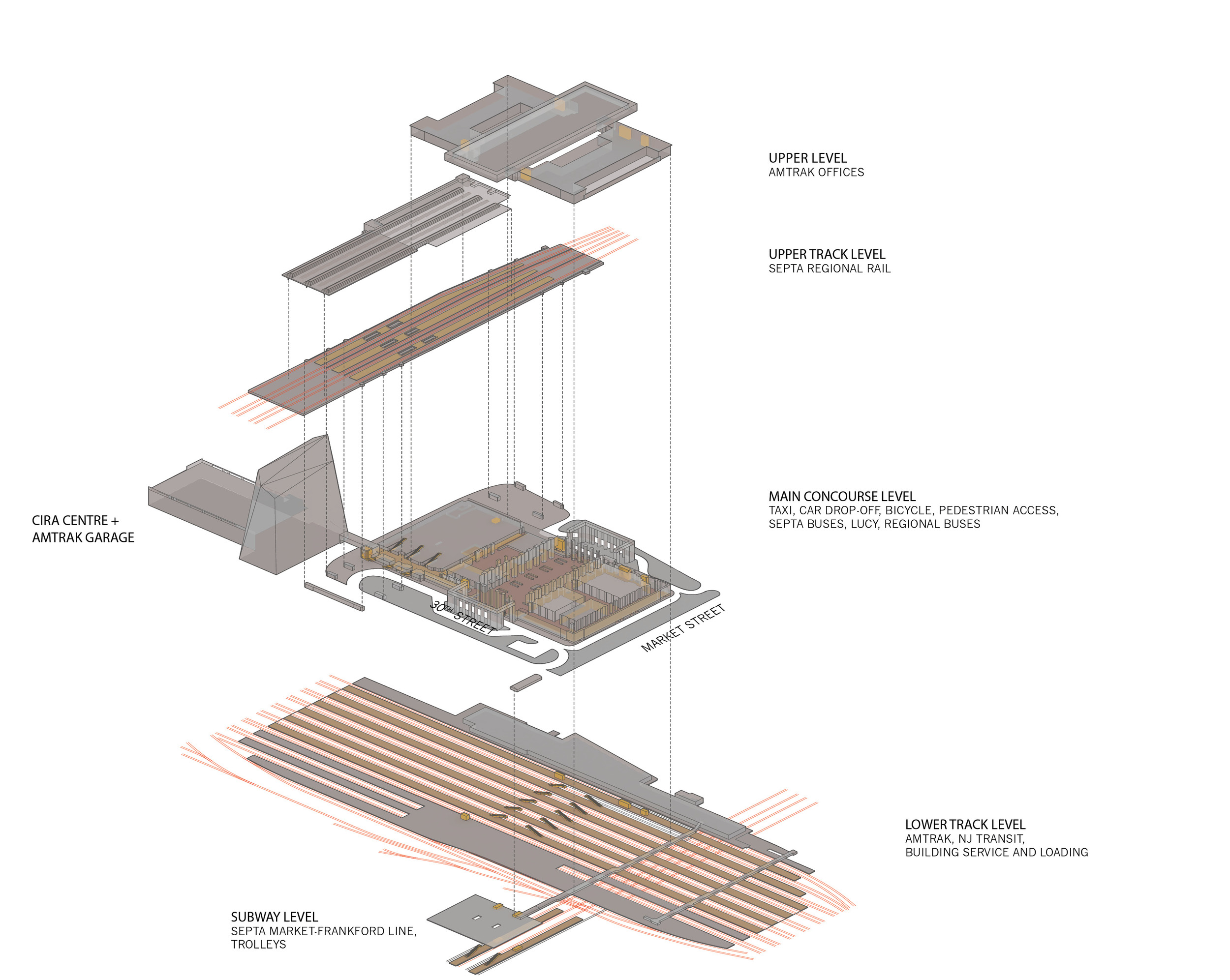
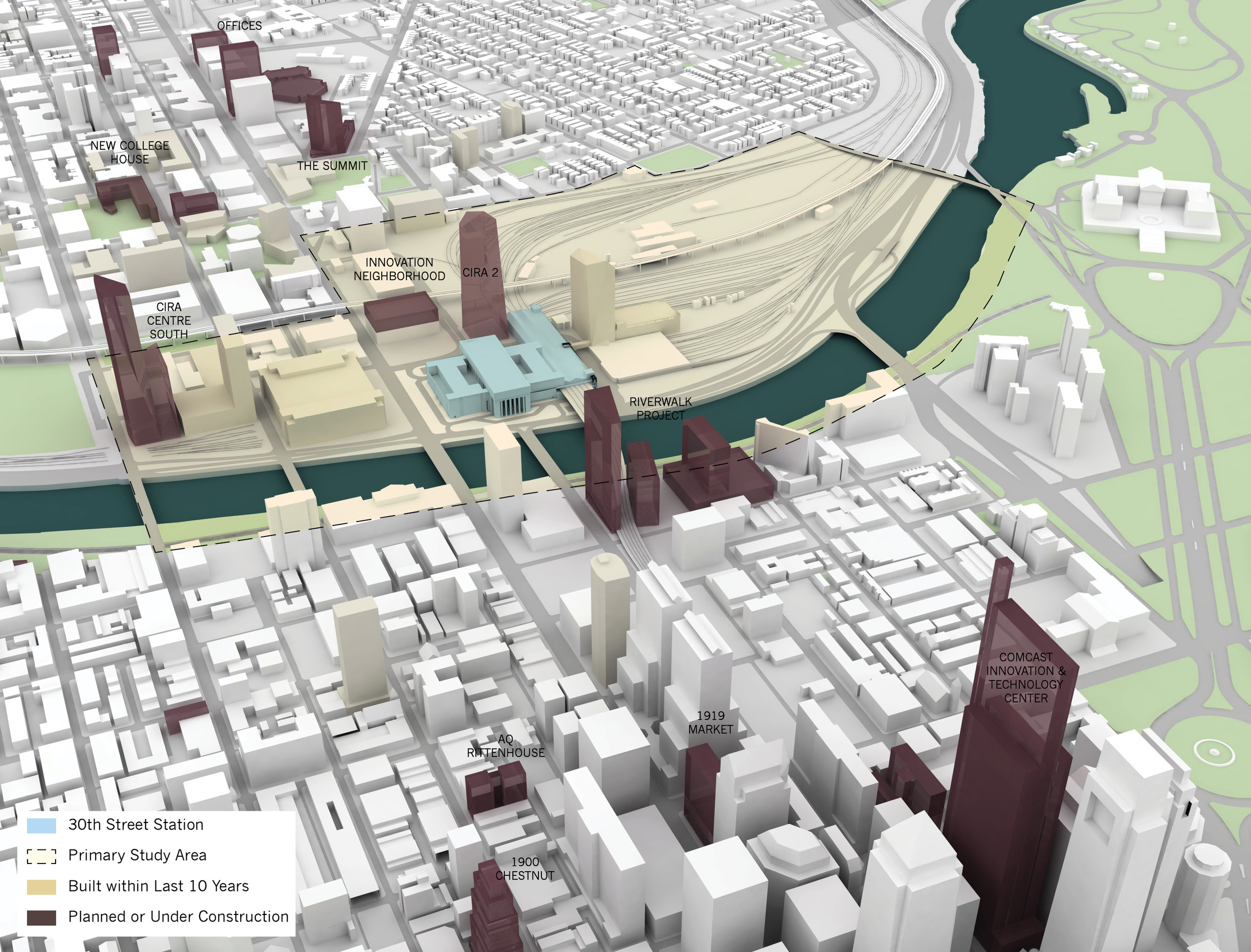
(Credits for study area maps: Skidmore, Owings, & Merrill LLP in association with Parsons Brinckerhoff, OLIN, and HR&A Advisors)